
Our core solution is a SaaS platform called APX®
It is an Asset Management orientated subscription service that offers objective reinvestment guidance for water utilities. Based on existing utility data, IoT device, SCADA system, smart meter, GIS or public data source it unleashes new value.
Modular based the APX® supports your decision-making by allowing you to choose the functionality required by your organization.
Unlimited no. of users
Network meetings with fellow water professionals
Onsite workshops
Daily replication of data
Our core solution is a SaaS platform called APX®
It is an Asset Management orientated subscription service that offers objective reinvestment guidance for water utilities. Based on existing utility data, IoT device, SCADA system, smart meter, GIS or public data source it unleashes new value.
Modular based the APX® supports your decision-making by allowing you to choose the functionality required by your organization.
The APX® modules
Click on each module to learn more
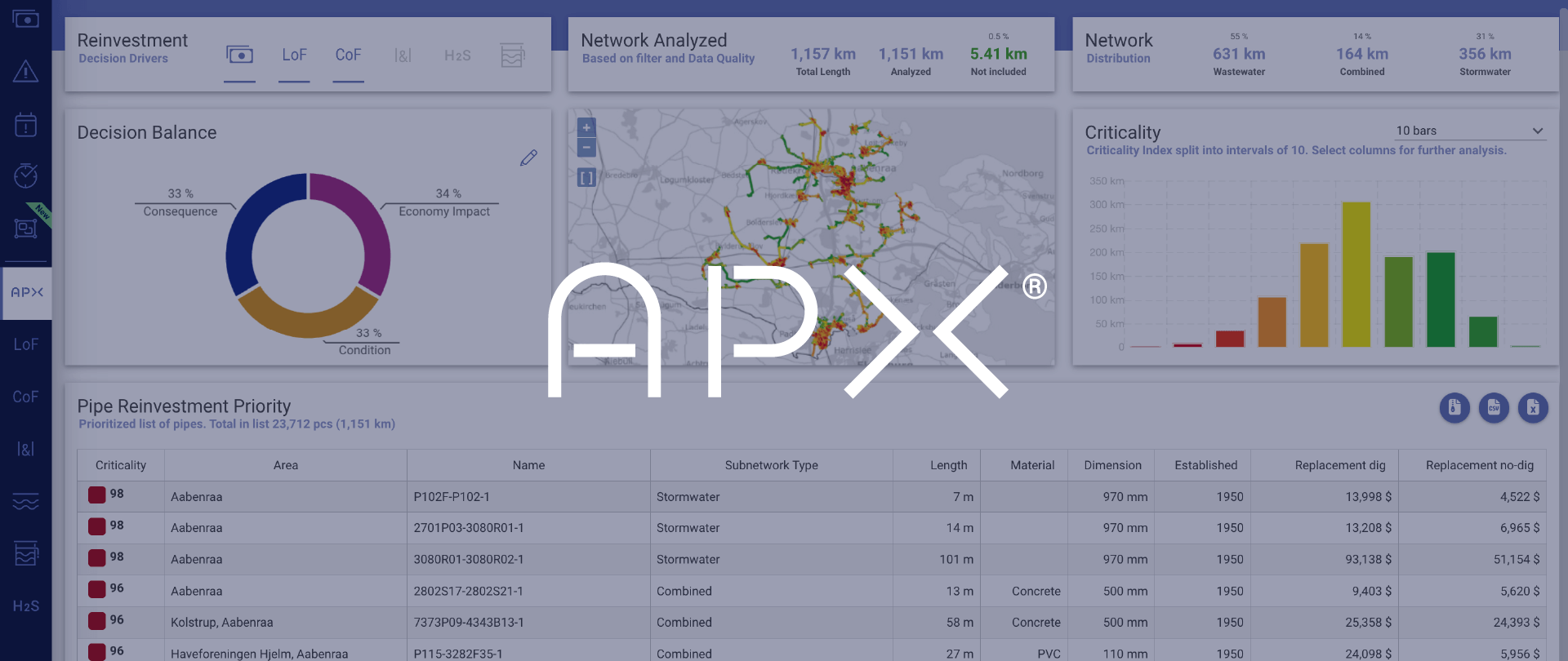
Reinvestment prioritization made easy
The APX module offers a unique way of operating with individual criteria for reinvestment prioritization.
Utility overview and data insights
Management reporting
The Dashboard module presents all critical aspects of the utility network – in one intuitive management-oriented overview.
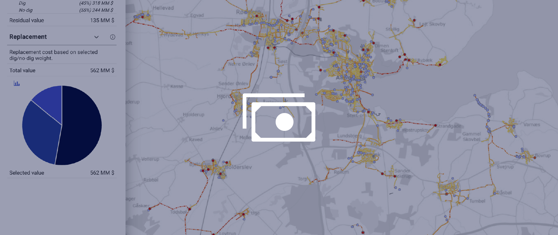
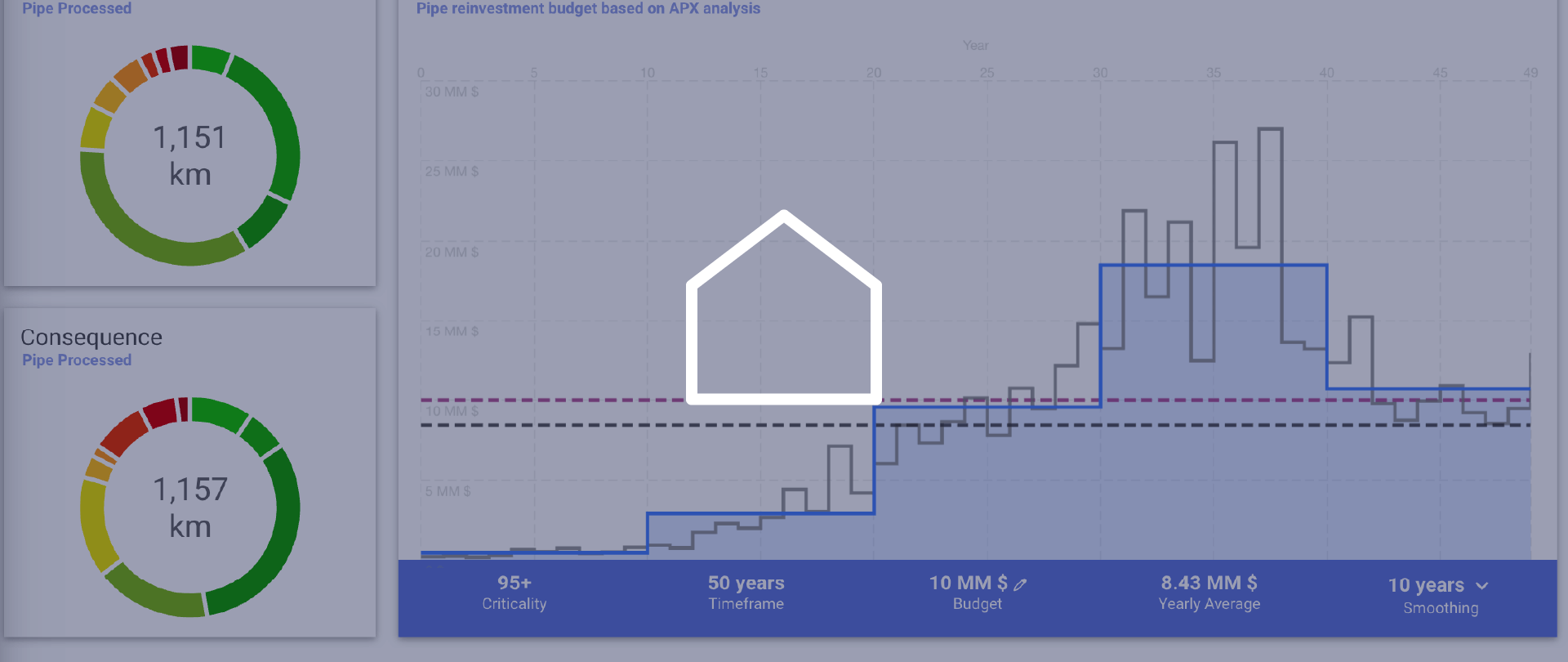
Financial investment impact
The Economy module of APX® brings detailed information of the financial impact related to network investments.
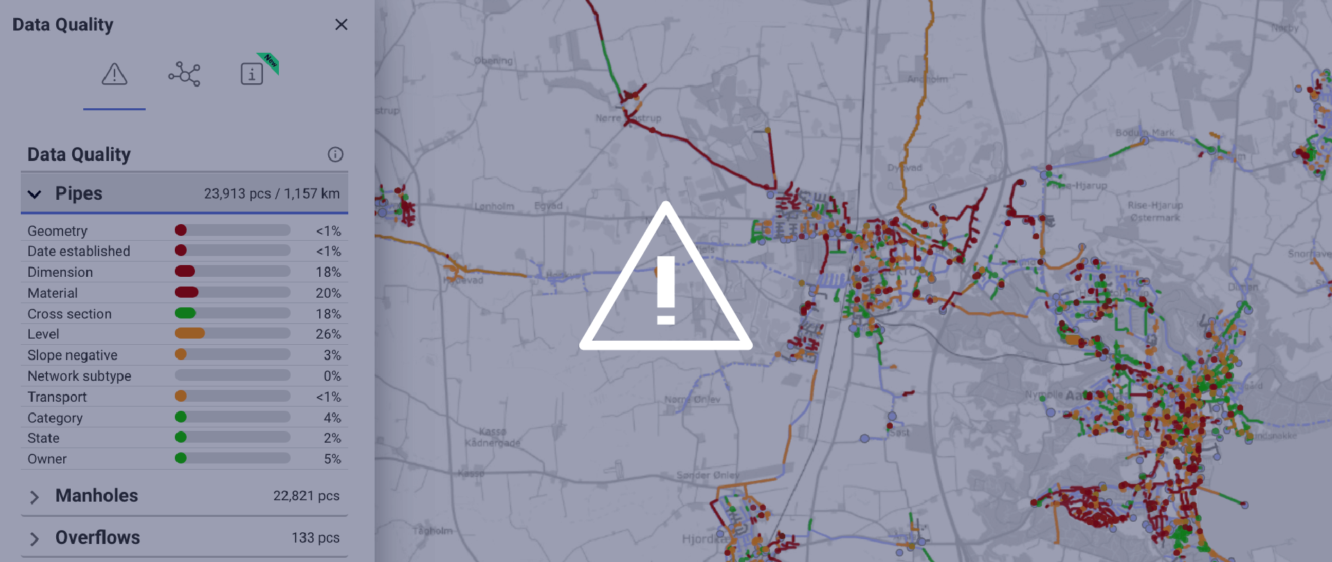
Data quality assessment
The Data Quality module brings immediate network and GIS insights to harvest full value of the utility network analysis of APX®.
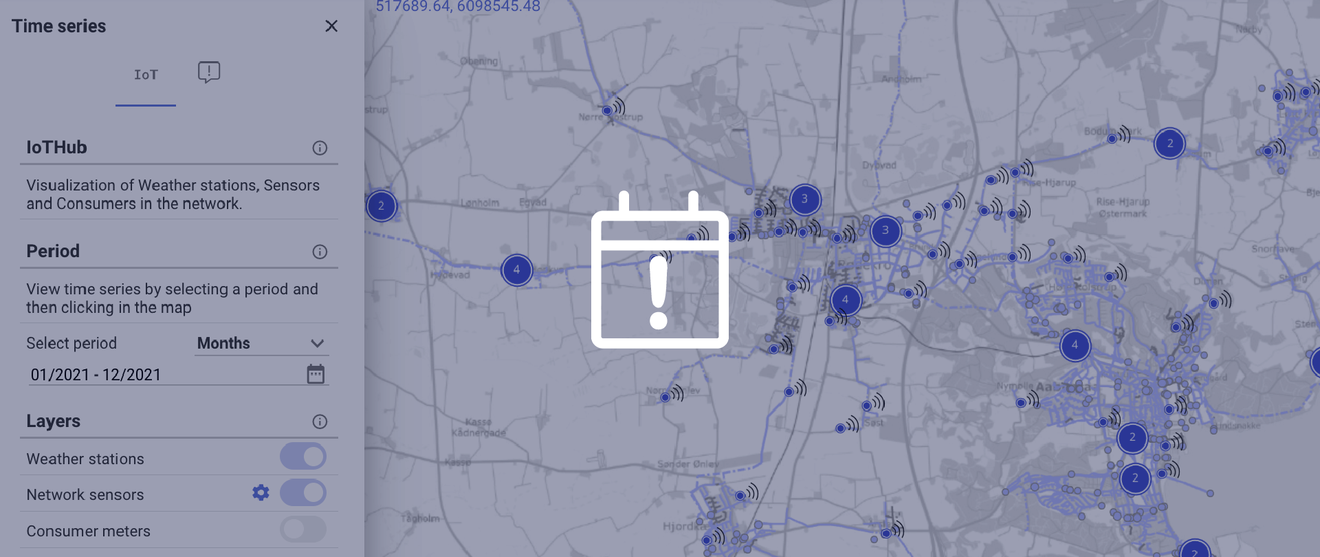
Sensor data and events
APX® integrate sensor and event data from any vendor for an easily accessible overview.
Asset Management
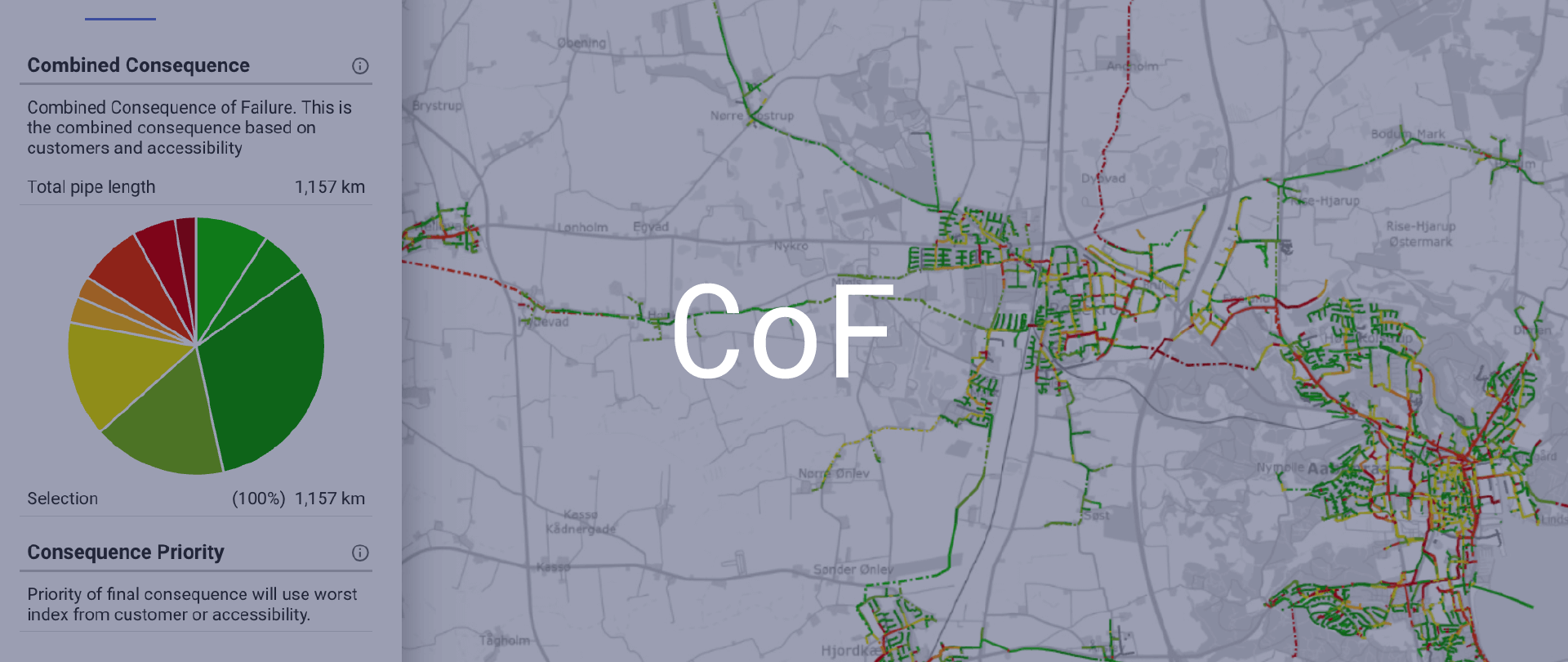
Consumer and accessibility risk
As a core component of Asset Management, the Consequence of Failure module presents critical insights of the surrounding effects of replacement and network breaks.
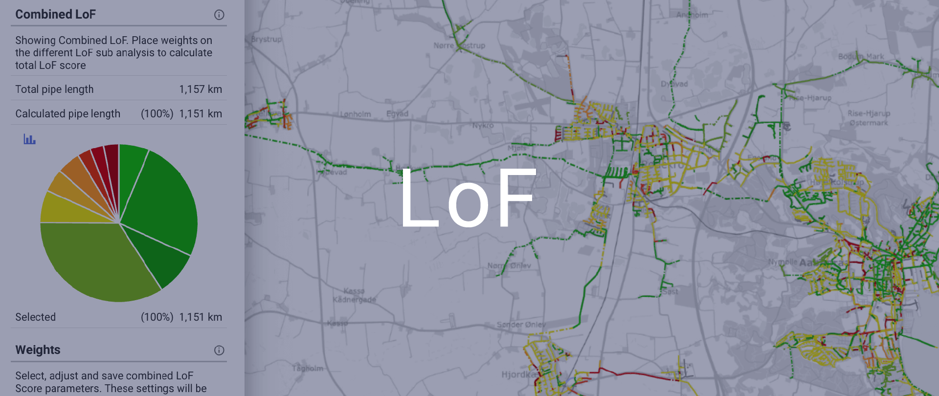
Network condition assessment
Through advanced machine learning algorithms, the Likelihood of Failure module can predict the utility network condition as well as applying existing inspections for a complete condition assessment.
Water & Wastewater challenges
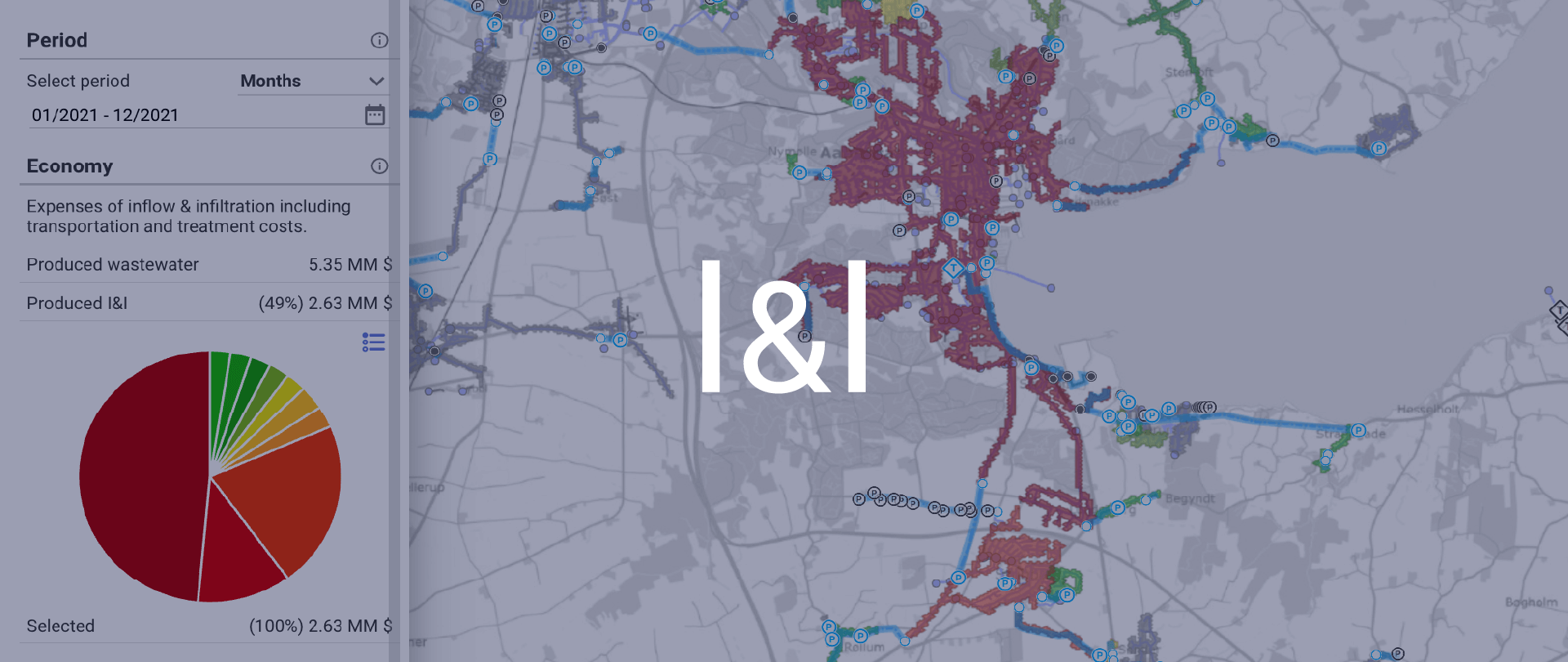
Inflow & Infiltration
Excess water that flows into a sewer network from stormwater or groundwater—also known as inflow and infiltration
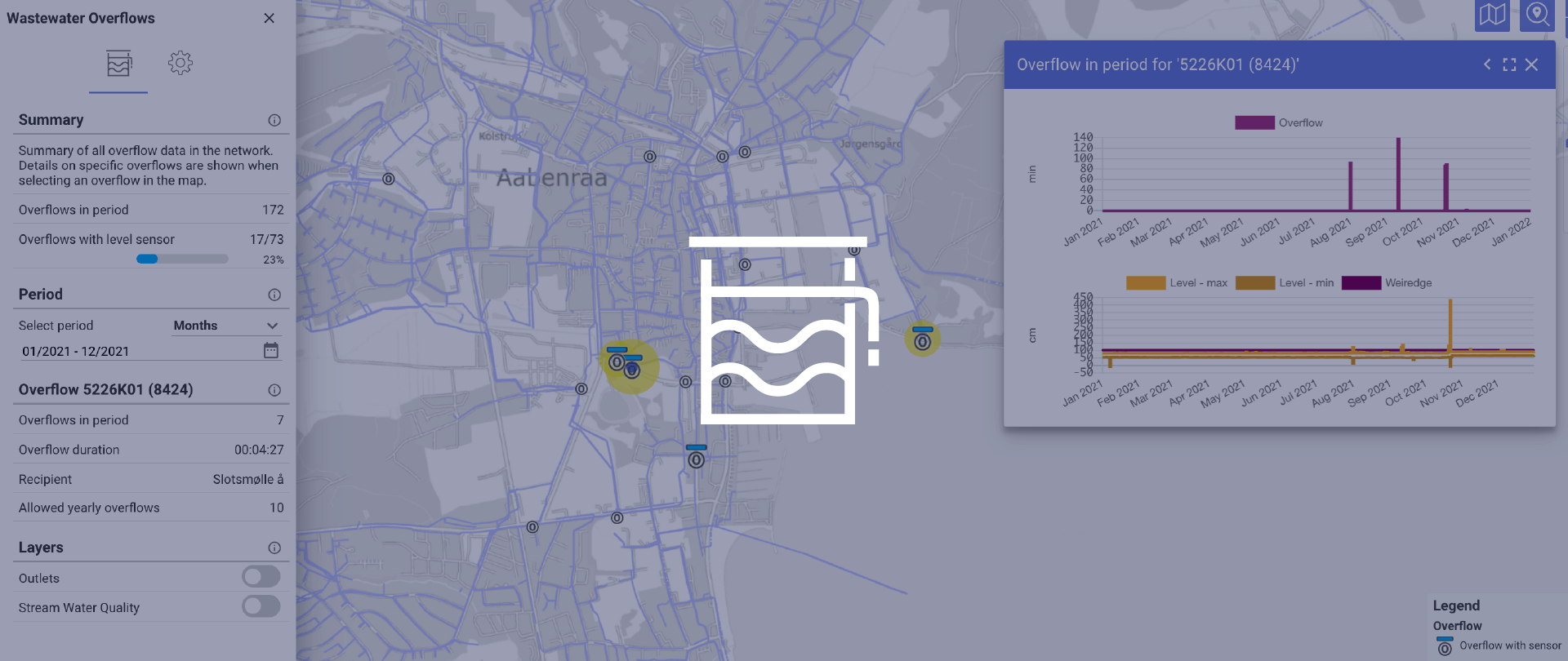
CSOs reporting
Combined sewer overflows (CSO) have significant environmental and economic impact on wastewater utilities.
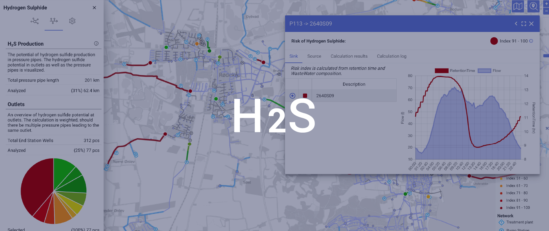
H2S network screening
Hydrogen Sulphide (H2S) can cause significant damage to the sewage network as well as odor challenges.
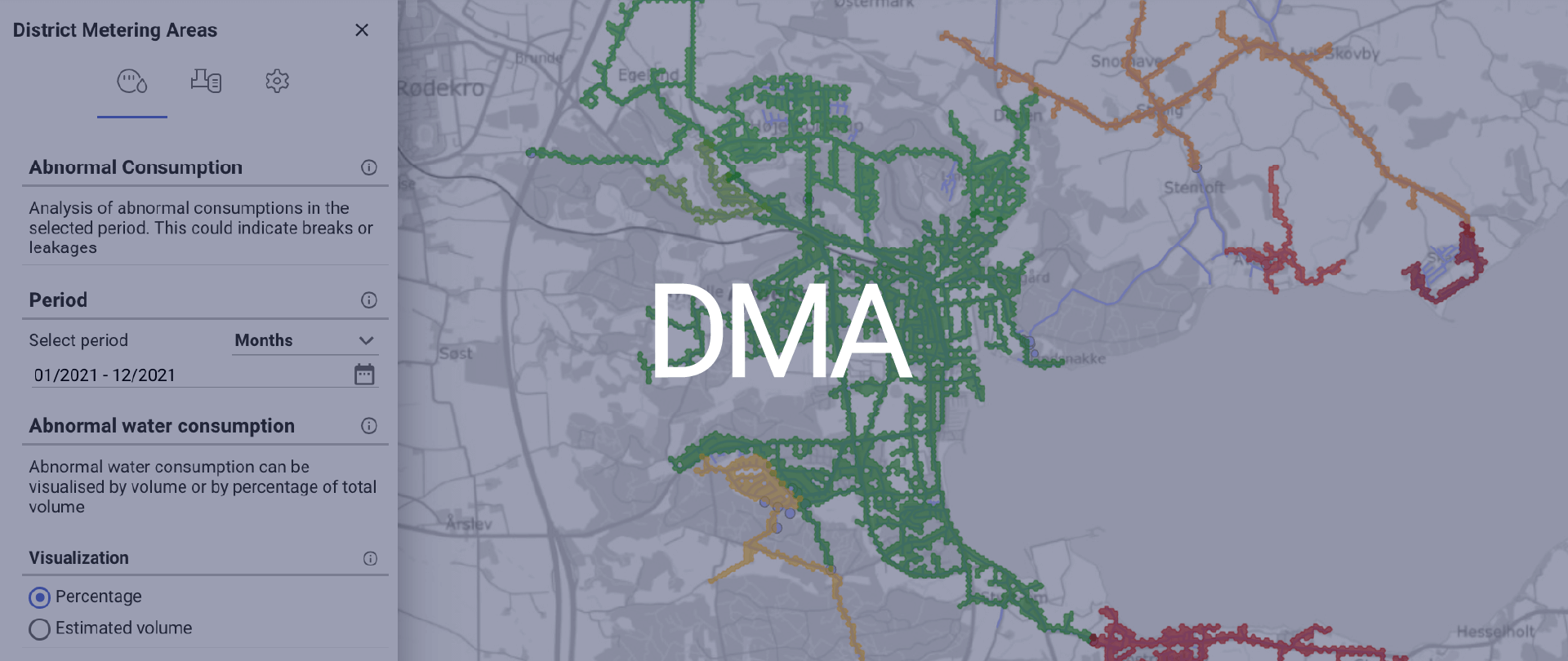
District Metering Areas
Getting insights on water consumption can often be an expensive and time-consuming process. By looking at District Metering Areas (DMAs) based on already existing flow meters and booster stations